-
What’s a carbon cycle?
The carbon cycle is the complex set of interactions involving several different carbon-based gases (among them the so-called “greenhouse gases”) that take place between the atmosphere, land, and oceans of the Earth. There are many “sources” of carbon generation; some of the most significant of these are associated with human activity such as fossil fuel consumption for energy production and transportation. The Earth’s environment also includes several carbon “sinks,” including bodies of water that chemically absorb certain gases, and vegetation that consumes carbon dioxide from the atmosphere via photosynthesis. Other factors, such as the size and distribution of the polar ice sheets and glaciers, play a significant role in the carbon cycle as well. Scientific research has shown that the atmosphere’s properties for retaining heat, or reflecting some of the energy from the Earth’s surface back towards the surface, are dependent upon the type and amount of carbon-based gases present, as well as their distribution through the atmosphere.
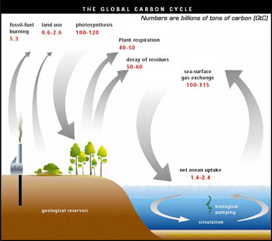
Many different carbon-based gases are released into the atmosphere through plant respiration and decay, the interaction of the oceans and atmosphere, as well as human activity, including agriculture and the burning of fossil fuels as an energy source. The concentration and distribution of carbon in the Earth’s atmosphere plays a significant role in weather and climate behavior.
-
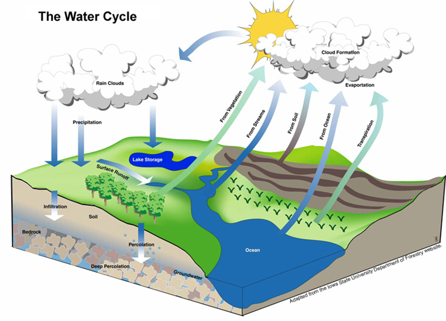
What’s a water cycle?
The water cycle refers to the movement of water between different parts of the Earth’s environment, including the atmosphere, natural reservoirs such as oceans and lakes, and the soil and rock formations making up the Earth’s land surfaces. In its different forms (water vapor, liquid water, and ice), water moves through the Earth’s environment cyclically, subject the complex interactions between land areas, oceans, and the atmosphere. This process is illustrated starts with liquid water from different sources – bodies of water, moist soil, and vegetation among others – is transported into the Earth’s atmosphere via evaporation and transpiration, where it is suspended in gaseous form and contributes to cloud formation. Areas within the atmosphere that become saturated with water vapor lead to precipitation, returning water to the Earth’s surface again in liquid form. Surface water, in turn, moves dynamically across, into, and beneath the land surface, re-accumulating in bodies of water, as well as underground reservoirs (e.g., groundwater).
-
What’s an energy cycle?
The energy cycle describes the interactions between energy sources within the Earth’s environment. These interactions are very complex, and even small changes in them can lead to significant changes in long-term climate behavior. A simple illustration of the major elements of the energy cycle is shown in Fig. xx below. Both the Sun and the Earth’s interior are sources of energy. That energy is distributed (and some of it is lost) within Earth’s environmental sphere in ways that contribute to both short-team weather and long-term climate behavior.
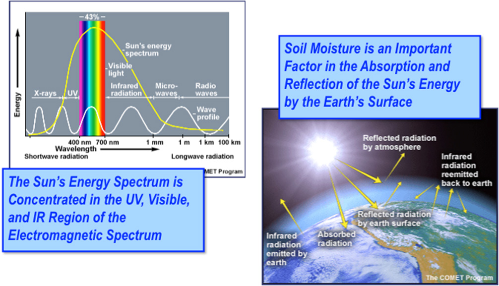
The energy cycle describes the interactions between energy sources within the Earth’s environment. These interactions are very complex, and even small changes in them can lead to significant changes in long-term climate behavior. A simple illustration of the major elements of the energy cycle is shown in Fig. xx below. Both the Sun and the Earth’s interior are sources of energy. That energy is distributed (and some of it is lost) within Earth’s environmental sphere in ways that contribute to both short-team weather and long-term climate behavior.
FAQ


