Soil Moisture Active Passive Validation Experiment 2015 (SMAPVEX15)
SMAPVEX15 and Science Objectives for a SMAP Aircraft-Based Field Campaign
During the post-launch Cal/Val phase of SMAP the major concerns related to validation are the assessment of SMAP products and improving the performance of the algorithms. The following is a list of science issues that can only be addressed using an aircraft-based campaign
- Validate the entire L2_SM_AP algorithm process; scaling and radiative transfer
- Understand the effects and contribution of heterogeneity on coarser resolution retrievals
- Evaluate the impact of known RFI sources on retrieval
- Correlative analysis of L1 product calibration and heterogeneity effects
- Investigate and resolve anomalous observations and products
For SMAPVEX15 the focus will be on the first item (L2_SM_AP). It is expected that it will also contribute to items 2-4. Identifying anomalous observations will require actual longer term data and it is expected that this will be a focus of future campaigns. Other science objectives will result from the campaign design and site selection.
SMAP provides soil moisture (SM) at 3 spatial resolutions; L2_SM_P (36 km), L2_SM_AP (9 km), and L2_SM_A (3 km). Of these the “flagship” SMAP product is the L2_SM_AP at 9 km; this drove the mission design and will satisfy the L1 mission requirements.
The current/baseline active passive (AP) algorithm uses the P and A observations to generate a “brightness temperature (TB)” (disaggregated brightness temperature) at a 9 km resolution. SM is then retrieved using the L2_SM_P algorithm.
The SMAP Cal/Val program will provide in situ, satellite, and model products that can be used to validate the soil moisture products. However, none of these resources can validate the entire L2_SM_AP retrieval process (disaggregation and retrieval) on a L2_SM_P basis. Using an aircraft-based radiometer to provide coverage of SMAP 9 km data cells is the only way to validate this critical component of the mission. Validating the disaggregation approach and the SM at 9 km will provide increased confidence in the product and/or insights that can be implemented to improve the algorithm.
Study Region: Walnut Gulch Watershed and Environs, Arizona
For SMAPVEX15, the study area will be the USDA-ARS Walnut Gulch Experimental Watershed (WGEW) and its environs. The Walnut Gulch Experimental Watershed encompasses the 150 square kilometers in southeastern Arizona, U.S.A. (31o 43'N, 110o 41'W) that surrounds the historical western town of Tombstone. The watershed is contained within the upper San Pedro River Basin, which encompasses 7600 square kilometers in Sonora, Mexico and Arizona. The watershed is representative of approximately 60 million hectares of brush and grass covered rangeland found throughout the semi-arid southwest (see Figure 1). Elevation of the watershed ranges from 1250 m to 1585 m MSL. Soils are generally well-drained, calcareous, gravelly loams with large percentages of rock and gravel at the soil surface. Cattle grazing is the primary land use with mining, limited urbanization, and recreation making up the remaining uses. Walnut Gulch, being dry about 99% of the time, is an ephemeral tributary of the San Pedro River (Figure 2).
Walnut Gulch has been the focus of several soil moisture remote sensing field campaigns and has an established measurement infrastructure that includes numerous rain gages and soil moisture sensors.

WGEW lies in the transition zone between the Sonoran and the Chihuahuan Deserts. The climate is classified as semi-arid, with mean annual temperature at Tombstone of 17.7°C and mean annual precipitation of 350 mm. The precipitation regime is dominated by the North American Monsoon with slightly more than 60% of the annual total coming during July, August and September.
A primary reason for the selection of the WGEW was the type of precipitation as related to the campaign objective of validating the L2_SM_AP. These summer events are localized short-duration, high-intensity convective thunderstorms driven by the intense solar heating of the land surface and moisture inputs from the Gulf of Mexico and Gulf of California. These events result in highly variable precipitation over the region, which would provide a range of conditions and enhance the robustness of the study.
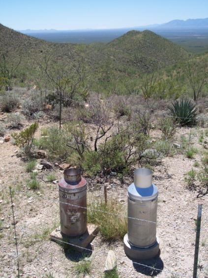
WGEW is one of the most densely instrumented semi-arid watersheds in the world. Rainfall is currently recorded on a continuous basis at 88 locations using digital recording weighing rain gauges. Vitel soil moisture probes have been installed at 19 locations on or near the 150 km2 Walnut Gulch Experimental Watershed in the vicinity of Tombstone AZ. All probes are co-located with electronic-measuring digital-recording rain gauges. All have a sensor at 5 cm depth. In addition, there are 7 sensors on the Santa Rita Experimental Range and an additional 26 sites in the Upper San Pedro River basin surrounding Walnut Gulch. All soil moisture sites are shown in Figure 3 below.

Enhanced Science Objectives for SMAPVEX15 in Walnut Gulch
Based upon the selection of the Walnut Gulch Watershed region, the following broader science objectives were identified as components of the campaign.
ARS Long Term Agro-Ecosystem Research-Characterizing and Scaling Walnut Gulch
The Long Term Agro-Ecosystem Research (LTAR) network is a new initiative with 18 research sites designed to understand the impact of agriculture on landscapes across America. The four LTAR goals are to increase agro-ecosystem productivity, address climate variability and change, conserve environmental quality, and improve rural socio-economic opportunities. The Walnut Gulch Experimental Watershed in southeastern Arizona is one of the 10 initial LTAR sites and represents the Lower Colorado River Hydrologic Unit, the Desert Southwest NEON Domain, and the Fruitful Rim Farm Resource Region. Quantifying the spatial and temporal distribution of soil moisture is critically important in understanding how climate and management jointly impact rangeland production, sustainability, and offsite effects. This knowledge will also support scaling insights from research sites like Walnut Gulch to the larger areas they represent. SMAPVEX15 will enhance the understanding of the watershed and its domain.
Validation of Global Precipitation Mission (GPM) Products
The GPM Ground Validation (GV) Program includes post-launch evaluation of the accuracy and utility of GPM data products for hydrologic applications. The USDA-ARS Walnut Gulch Experimental Watershed (WGEW) and surrounding Upper San Pedro (USP) region has been proposed as candidate for these activities. Targeted questions that have been identified will address both the enhancement of GPM retrieval accuracy in semi-arid environments and the utility of GPM observations for water resource applications. These activities will benefit greatly from the simultaneous acquisition of ground-, airborne- and satellite-based soil moisture data products during SMAPVEX15.
Multi-frequency Radar Study for AirMOSS and UAVSAR
The AirMOSS and UAVSAR instruments will be flown during SMAPVEX15. Measurements of backscattering cross section provided include the compound effects of vegetation and soil. At L-band (UAVSAR), the signals are expected to penetrate no more than a few centimeters into the ground; in the presence of substantial vegetation (more than 5 kg/m2), they are not expected to have much sensitivity to soil moisture. However, the long wavelength of P-band radar (AirMOSS) can penetrate significant distances into the soil – tens of centimeters - and carry information about the subsurface soil profile. Their sensitivity to soil moisture is also significantly less impacted by the presence of vegetation up to 10 kg/m2 or even more. Simultaneous measurements by AirMOSS and UAVSAR will be used to explore new algorithms that may provide soil moisture profile and vegetation information.
SMAPVEX15 Aircraft Component Design
A key requirement of the experiment is higher spatial resolution L-band brightness temperature (TB) coverage of the entire site that can be used to generate TB values for the L2_SM_AP (9 km) as well as the L2_SM_A grid (3 km). The SMAP L2_SM_P algorithm(s) would be used with this data to generate SM products at both 3 and 9 km using the ground sampling to validate the higher spatial resolution retrievals. Radar observations are also required in order to validate all algorithms. A variety of soil moisture conditions is needed for a robust analysis. Therefore, flights will be conducted over an extended period concurrent with SMAP morning overpasses. In order to increase the likelihood of spatial and temporal variability in soil moisture conditions, the experiment will take place during the Summer Monsoon. The primary period will be August 2 through 18, 2015. Three aircraft sensor systems will be utilized:
- PALS: For SMAPVEX15 the well-established Passive Active L-band System (PALS) will be a key component. It was recently converted to a scanner that will be capable of collecting data more efficiently. Planning and budgeting was based on two primary requirements; collecting the data set within a 3-hour window in order to minimize diurnal temperature effects on the ground conditions and a maximum spatial resolution of 2 km in order to provide an adequate sample size for all soil moisture products. After considering the instrument and aircraft parameters it was decided that it was possible to satisfy these criteria and cover a domain consisting of three adjacent SMAP 36-km grids. This assumes an altitude of 3000 m and an airspeed of 100 kn. The study area and PALS flightlines are shown in Figure 3.
- UAVSAR: The Uninhabited Aerial Vehicle Synthetic Aperture Radar (UAVSAR) is an aircraft based fully polarimetric L-band radar that is also capable of interferometry. It is currently implemented on a NASA Gulfstream-III aircraft (http://uavsar.jpl.nasa.gov/). For SMAPVEX15, the nominal flight altitude is 13 km and the aircraft speed is 220 m/s. UAVSAR looks to the left of flight direction and collects data over a swath between 25 and 65 degrees, which is a nominal swath of 21 km. The UAVSAR flight lines are intended to provide coverage of the PALS domain at a higher resolution and to also match the area covered by AirMOSS. AirMOSS will be flying a standard set of lines that have been used for all its flights. All lines must be flown in the same direction. The most relevant portion of the UAVSAR data swath for SMAP, which has an incidence angle of 40 degrees, will be data collected close to that angle. There are techniques that can be applied to normalize observations at other angles to 40 degrees; however, the accuracy degrades as the range increases. Several lines will be flown in order to provide this product.
- AirMOSS: Airborne Microwave Observatory of Subcanopy and Subsurface (AirMOSS) is a P-band (280-440 MHz) synthetic aperture radar (SAR) instrument flying on the NASA JSC GIII aircraft, and the principal instrument for the EV-1 mission by the same name. AirMOSS is producing estimates of root zone soil moisture with data from the P-band SAR to capture the effects of gradients of soil, topography, and vegetation heterogeneity over areas of 100 km x 25 km at 9 biomes in north America during 21 annual campaigns in 2012-2015. WGEW is one of its study sites. LINK The instantaneous nominal swath for AirMOSS will be approximately 20 km, but the part of the swath for which calibration accuracy meets the AirMOSS soil moisture retrieval requirements is limited to 25-55 degrees, which is less than 10 km. As a result, to achieve the planned total swath of 25 km, the flight plan consists of 4 parallel lines, flown as two racetracks. The SMAPVEX15 flight plans for AirMOSS and the UAVSAR are nearly identical, by design, so that both instruments cover the same area with the same range of incidence angles. The two instruments will fly within a few hours of each other.

Ground-based Observations
Ground-based information is a key element of a validation campaign. A design goal for SMAPVEX15 is to minimize the need for a large ground team due to expense and safety concerns. Data will consist of the following:
- Existing networks of precipitation gages and soil moisture sensors
- A temporary network of soil moisture stations. Approximately 80 stations will be deployed in the region. These will provide a convenient alternative to field sampling which can introduce additional errors.
- Gravimetric soil moisture sampling that includes bulk density and rock fraction.
- Vegetation and roughness sampling
- Spatial soil moisture mapping with a COSMOS Rover.
- Supplemental ground-based rainfall instrumentation will be deployed to the enhance the existing operational observing network: 1) two X-band mobile scanning radars, 2) approximately 25 research-quality calibrated tipping bucket rain gauges, 3) three laser disdrometers, and 4) three vertically-profiling k-band FMCW radars.
Flight Schedule
The primary driver for the selection of flight days within the selected study window is the availability of a SMAP descending (6 am) overpass on that day. SMAP is in an eight-day exact repeat orbit. The satellite provides data over a swath of approximately 1000 km; however, high-resolution 3 km radar data of acceptable quality is not available within 150 km of the satellite ground track, which means that it is not possible to perform either active or active passive soil moisture retrieval in this 300 km wide swath. This results in some peculiarities in the temporal coverage of a location on the ground. Using the science orbit predictor tool for SMAP (http://smap_op.apps.nsidc.org/), the coverage during August for WGEW was obtained. Note that these are predictions. They are expected to be fairly accurate but will be reviewed frequently. Results are summarized in the Table below.
The current plan, subject to a review of the track closer to the campaign and the weather conditions encountered is to fly PALS a total of seven times. August 2, 8, 10, 16 and 18 would provide all necessary SMAP data. In addition, the radiometer only dates of August 5 and 13 would be flown (because the site is close to the nadir track). The UAVSAR and AirMOSS would fly on four dates; August 8, 10, 16 and 18.
Another consideration in choosing flight days is the availability of data from other satellites providing brightness temperature, backscatter, or soil moisture estimates. These include SMOS, Aquarius and AMSR2 (GCOM-W). Coverage during August at the study period is shown in the table below. The anticipated PALS flights on August 2, 5, 10, 13, and 18 would coincide with SMOS and provide a total of 5 concurrent radiometer data takes by SMAP and SMOS. The Aquarius coverage is sparse and only possible on August 8; however, the location is not ideal. AMSR2 data is collected in the early morning (~1:30 am) and mid-afternoon (~1:30 pm). Neither of these is well suited for direct comparison with SMAP but may be of some value in analyses.

