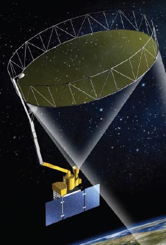
SMAP is a remote sensing observatory, designed to carry two instruments that will map soil moisture and determine the freeze or thaw state of the same area being mapped. Soil moisture content can be mapped via the radiometer data at a spatial resolution of 36 km every 2-3 days. A combination of radar and radiometer measurements would lead to a soil moisture product at a spatial resolution of 9 km. The freeze/thaw mapping could be accomplished using unique properties of the radar system’s measurements at a spatial resolution of 3 km. After the failure of SMAP radar in early July 2015, the SMAP radiometer data has been used to produce the freeze/thaw map at a resolution of 36 km. Both the radar and radiometer share a common antenna and feed assembly externally, but their electronics inside SMAP are different.

The radiometer detects radio waves that are emitted by the ground from the same area. The strength of the emission is an indicator of the brightness temperature of the ground in that location. Since a radiometer passively makes these brightness temperature measurements, this is where the ‘passive’ in SMAP comes from.
The large antenna that is shared by both radar and radiometer is SMAP’s most prominent feature. It operates just like a satellite dish, only is much larger, where a reflector collects all of the radio waves which focuses them into the feedhorn. Like a funnel, the feedhorn collected the echoes from the radar, and it has been acquiring the surface emissions from the radiometer. The radar and radiometer electronics are separate for processing images. The feedhorn is a large cone visible on the outside of the spacecraft. The antenna reflector is a mesh antenna 6 meters (about 20 feet) in diameter.

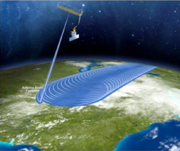
SMAP’s orbit is 685 km (426 miles) above Earth’s surface. Because Earth spins while SMAP orbits, swaths from each orbit are offset from each other and, after 8 days, the same swath is repeated. Over 2 to 3 days (2 days at the poles and 3 days at the equator), the gaps between swaths are filled in and a global map of moisture and frozen land can be prepared. Data taken by SMAP’s two instruments run from pole to pole. The orbit is oriented such that it crosses Earth’s terminator at the equator. (The terminator is the boundary between day and night, either at sunrise or at sunset.)


