Multimedia
SMAP shows progression of spring thaw
The radar measurements made by NASA's Soil Moisture Active Passive (SMAP) observatory are sensitive to whether land surfaces are frozen or thawed. As liquid water freezes in soil, the water molecules become bound in a crystalline lattice, which changes how the incoming radar energy from SMAP interacts with Earth's surface, compared to soil containing freely oriented liquid water molecules.
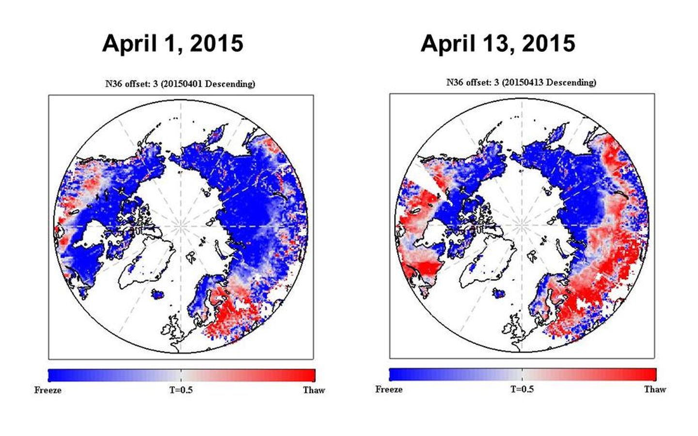
SMAP's radar measurements will be used to provide a 1.9-mile- (3-kilometer) resolution daily classification of whether soils are frozen or solid for land areas north of 45 degrees North latitude. Initial data from SMAP capture the 2015 spring thaw progression over the Northern Hemisphere, with a thaw front extending from predominantly non-frozen southern latitudes to the still-frozen north. Shades of red indicate regions where the landscape is thawed; shades of blue correspond to frozen areas. The transition from frozen to thawed conditions is evident over extensive regions between the two images, acquired April 1 and April 13. For instance, the progression of melt northward across Alaska is evident, along with changes across the boreal forests of northern Canada. Large areas of Russia also changed from frozen to thawed. The SMAP radar measurements indicate frozen soil conditions for some regions near the southern edge of the maps (in the United States and Eurasia), even though these regions are now thawed. This is a result of the influence of other characteristics of the land surface, such as soil moisture, on the radar signal. These mid-latitude regions also undergo a much more moderate freeze cycle each winter, which weakens the SMAP radar's sensitivity to the freeze/thaw state in these areas. Read more here.
Credit
NASA/JPL-Caltech
